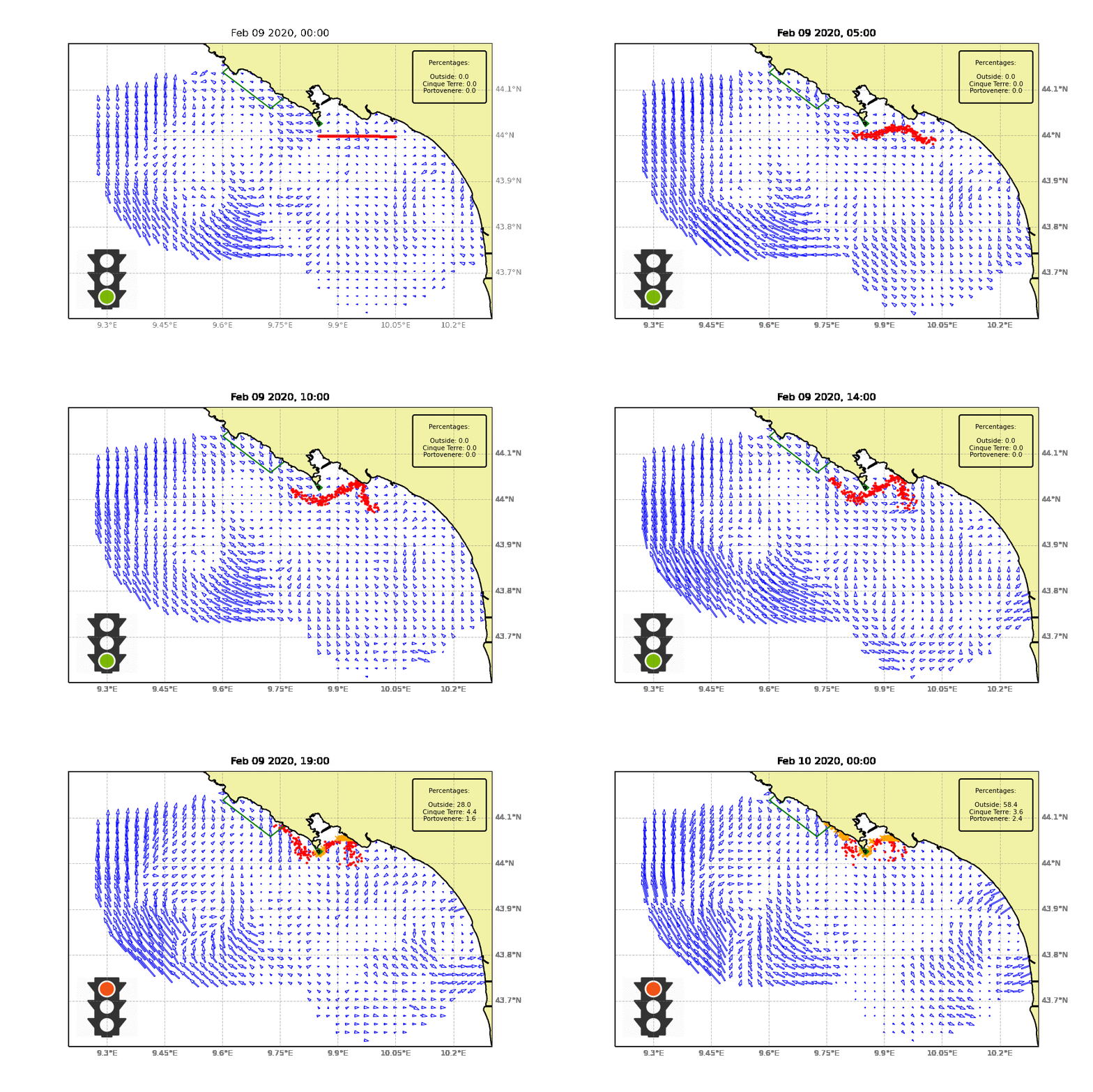
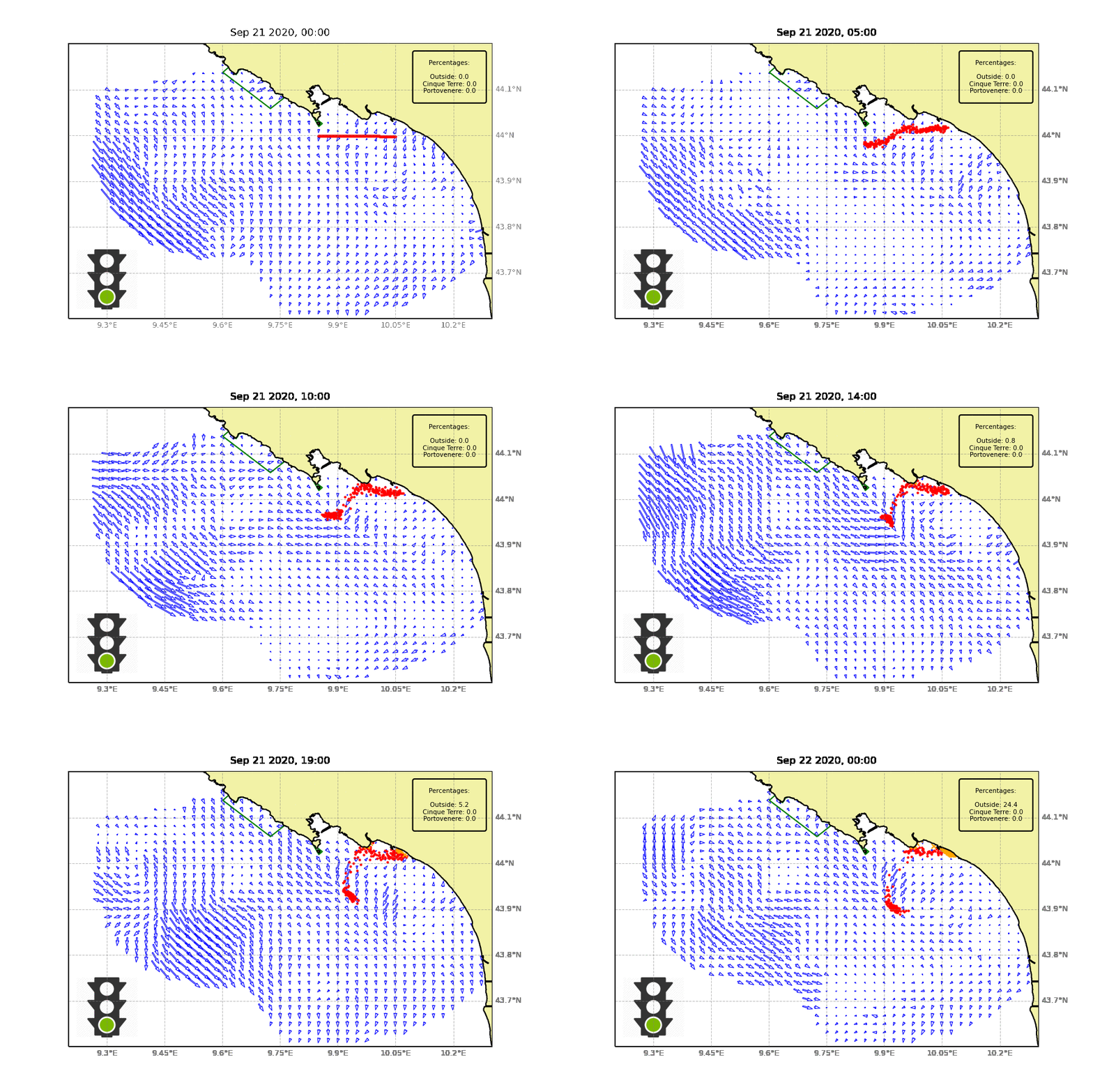
HF radars measure the high variability of surface currents which transport substances at sea. Once the currents are known, it is possible to apply dispersion models and calculate the ways (most probable trajectories and travel times) according to which certain pollutants disperse into the sea from a source. This information can be used in the prediction of potential interactions between port activities and surrounding areas, in order to assess their potential impact and the most favorable conditions for their implementation.

In the area in front of the Cinque Terre, for example, potential contaminants from the port of La Spezia (red dots in the animations) are transported by surface currents (blue arrows) towards the boundaries of the marine protected area (green lines) especially in the winter period, when HF radars record coastal currents moving northwestward. The traffic light indicator turns red, showing the unfavorable conditions.

In summer and early fall, currents move in the opposite direction, transporting potential pollutants away from the most valuable natural areas. The traffic light remains green, indicating the favorable conditions for port activities.