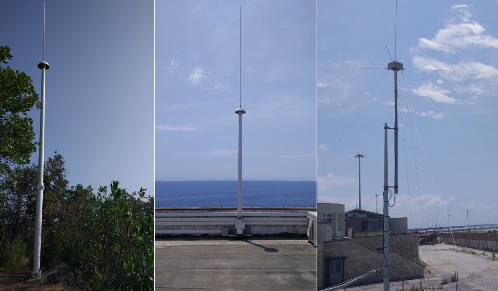
HF radars are remote sensing instruments. They obtain updated information on the state of the sea, in particular on the surface sea currents and wave motion, and they make it available automatically every hour.
Each pair of HF radar stations allows the continuous monitoring of currents over an area of about 5,000 Km2, by operating at the frequency of 13.5 MHz, one of the most used.
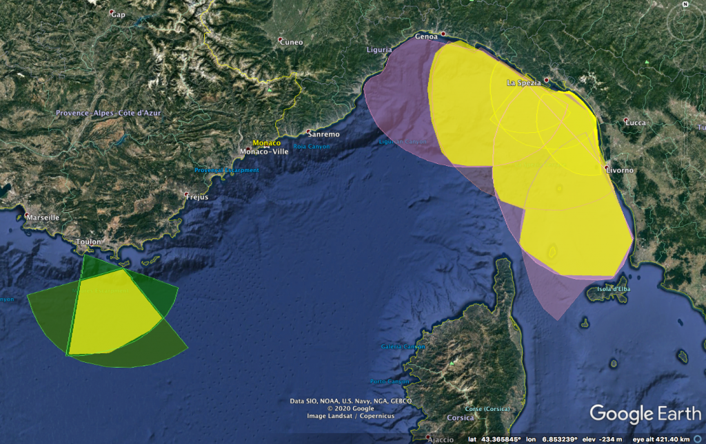
The IMPACT project has invested in this technology in order to increase the number of HF radar stations (operating on the coasts of the transboundary area), both with the purchase of new units, both with the restoration of obsolete ones. The result of this investment is an operational observational system that covers 200 km of coastline, equal to 40% of the total length of the Italian-French coast between Piombino and Toulon. The stations are located in strategic zones (presence of important ports and marine protected areas), mostly between the regions Tuscany and Liguria, but also in the region South PACA, by monitoring a total area of 16.000 Km2 (figure 1).
IMPACT has also encouraged the creation of a network between the different managing entities of the instruments, by promoting shared management models that improve the sustainability and usability of the entire system. Thanks to this collaboration it is now possible to share knowledge and best practices for installation and management of tools, to apply standards in data management and to create interoperable datasets for the applications provided by the project.
The first transboundary HF radar network between Italy and France was created. IMPACT capitalises investments on HF radar technology, thanks to RITMARE, MOMAR and SICOMAR projects; it also starts a further expansion of the network, thanks to Interreg SICOMAR plus and SINAPSI projects.
Globally, HF radars are widely used for coastal monitoring and the number of installed stations, currently around 500, is constantly growing. The applications are both scientific and practical; in the United States of America for example, the extensive network, covering almost completely both coasts, provides the Coast Guard with current data and additional information, to support search and rescue operations.
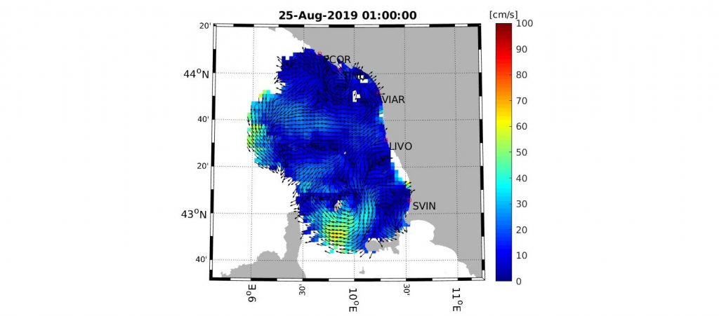
In the IMPACT project, HF radars provide frequent and extensive information on surface currents (figure 2), they are part of an innovative and multidisciplinary approach. They also contribute to the complete recognition of the currents, which are the basis of the transport of substances at sea, together with outputs of numerical models in a cross-validation process. Once the currents are known, it is possible to apply dispersion models and to calculate the way (probable trajectories and time required) certain pollutants are dispersed into the sea from a source. This information, used in the forecast of potential interactions between port activities and adjacent and distant areas, can provide useful tools to assess the impact of such activities on marine protected areas. It is also useful in order to develop guidelines for an optimal management of ports and protected areas, both basic elements of the Blue Growth.
